Nature trails
We suggest several nature trails, feasible independently, to enjoy the beauty of the Appennino Pistoiese area in total safety.
Clear air, greenery, peace and quiet; between forests and water streams, the Mountain welcomes you with its relaxing and magical landscapes, coloured by the beautiful foliage of the season.
The Ecomuseum pathways
The Icehouse pathway – Le Piastre (PT)
From the parking lot at Le Piastre, cross main road 66; a few metres ahead, in the direction of San Marcello Pistoiese, you will find the start of the Ecomuseo trekking path, clearly signposted.
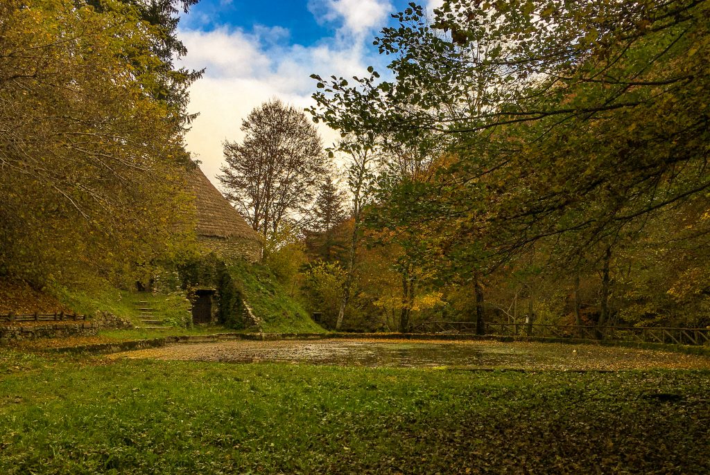
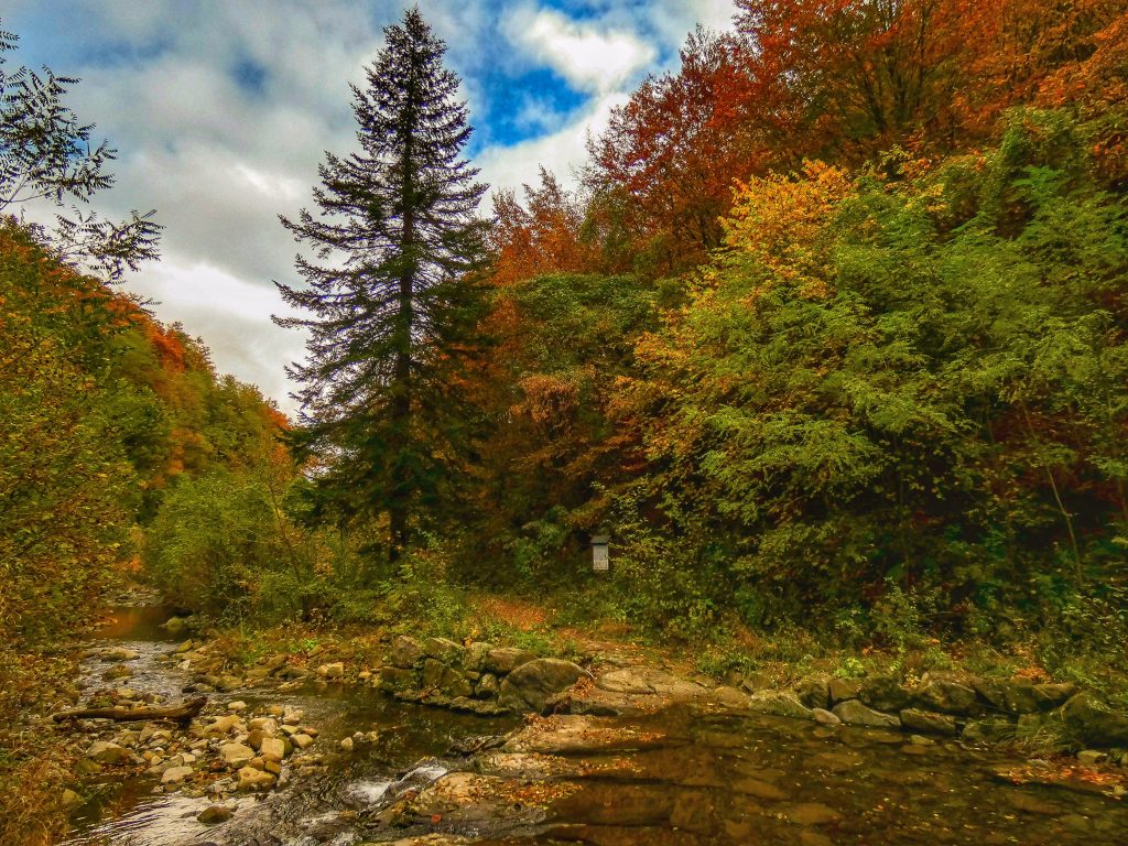
This path is about 1 km long; after crossing three iron pedestrian bridges you will reach the Madonnina Icehouse. You will be walking along the river Reno, whose source is in Prunetta, just a few kilometres upstream.
The unique and capacious structure from which its name is derived was used until the early decades of the twentieth century to store tons of natural ice; the latter was produced during the wintertime, when the temperature in the valley dropped well below zero, causing the river water to freeze in the lake, where the profile of our Icehouse is now mirrored.
Level: easy
Completion time: 1h return
There are picnic areas along the path.
Clicca qui per scaricare la mappa
The Iron pathway – Pontepetri (PT)
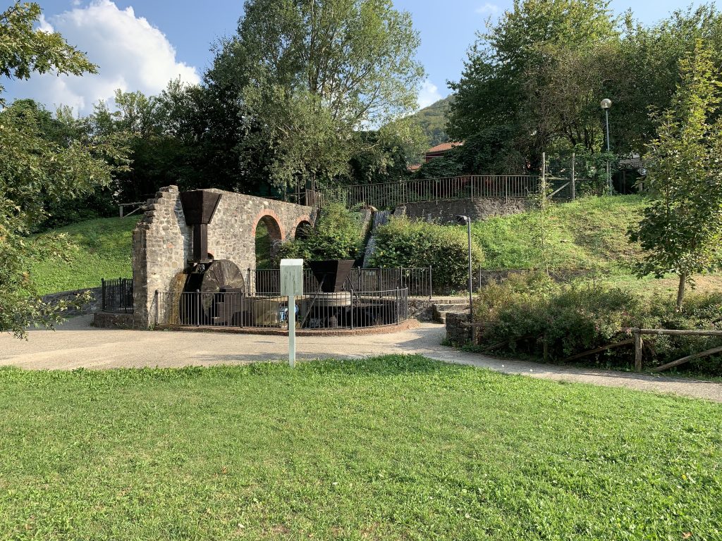
The Iron trekking path starts from the village public gardens; it is a nature trail about 800 m long, winding along the course of the Torrente Maresca stream. A pleasant walk in nature, leading to the water intake on the river.
Near the path flows the old artificial canal, which used to power the Ironworks in Pontepetri, dating to 1700 and decommissioned 1978: witness to the historical trade of local ironsmiths are the large wooden hydraulic installations: wheel, power hammer, as well as two grindstones, which have been reconstructed in the Green Power Garden and are now water-operated.
Level: easy
Mostly accessible also with a stroller
Completion time: 1h return
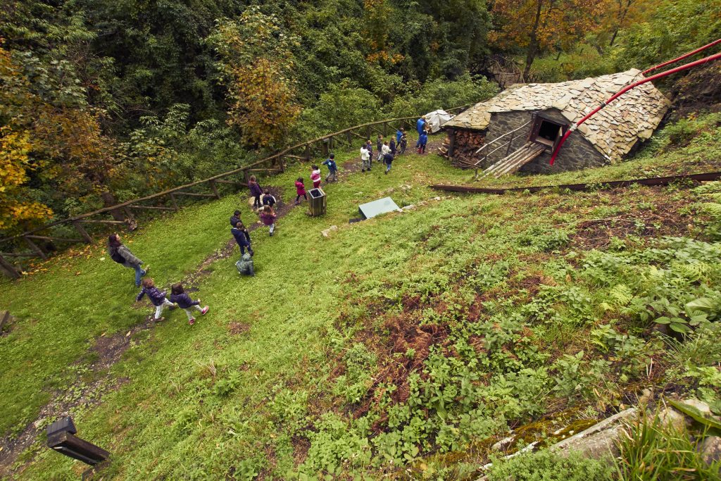
The path services include: playground, picnic area, drinking water and a grill for barbecues.
Toilet facilities are open only on request. In the village you will find a café, grocery store, bakery (closed in the afternoon), restaurants and a pizzeria.
Clicca qui per scaricare la mappa
Ice trekking
For advanced trekkers: we suggest a ridge path on a wide dirt road starting from Madonnina Icehouse – Le Piastre, and ending in Pontepetri, in the Green Power Garden. The path is called “Tracciolino” and it was opened in the 1960s, as service road for the construction of the Bacino del Reno which was actually never completed. There are 9 km of unpaved road on the mountains enclosing the Reno valley. The road is gently sloping, except at the beginning where you walk up to the ridge (after crossing the Reno on huge boulders at the foot of the Ghiacciaia), then towards the end, when you walk down the ridge in the direction of Pontepetri, down to the level of the Reno river. On the highest stretch a broad view: far away – to the left – the Rifugio del Montanaro and Poggio dei Malandrini; to the right you have the whole plain of Pistoia, Prato and Firenze: on a clear day you will be able to catch a glimpse of Brunelleschi’s Dome and of Giotto’s Campanile.
The route is clearly signposted, both as Ecomuseo Trekking, and as Cammino di San Bartolomeo (with small yellow arrows): the two paths coincide in this 9-km stretch.
Completion time: 2h
Typical small fountain at Le Piastre, in the parking lot, with statues of deer (sculpted by Leonardo Begliomini); in Pontepetri, Fontana del Duca, near the old sports ground, to the right, just before you get to the village. To get back to the car, which you have parked at Le Piastre, you can take a bus, towards Pistoia, and in 10 minutes you will reach Le Piastre. The stop is at Pontepetri, on main road 66, to the right of the café I Mammalucchi.
Clicca qui per scaricare la mappa
The Chestnut way – Orsigna (PT)
After the village of Pracchia, towards Porretta Terme, take the first turning left, uphill, towards Orsigna. After a few km you will get to the Ponte di Santella bridge, leaving the detour to Vizzero on your right, continue along the main road until you reach “Villanova”, then turn off towards “La Menta” and the sports ground, slightly downhill to the left; after about 1 km, park near Ponte di Quadrano, a new wide bridge, turn left without crossing it; continue on foot along the road you came from.
After about 2 km on a wide unpaved road, in the forest and up a slight slope, you will reach Giamba’s mill; built in the first half of the nineteenth century, one of the few working watermills in Tuscany. Below, under the vaults, two clearly visible wheels (known as ritrecini) move the grindstones. Turn right (the path starts getting steeper), walk by the side of the mill and a fountain with very good water, cross the two bold wooden bridges, built on the basis of a project by the genius from Vinci, and you will reach the metato, i.e. the outbuilding where – in November – chestnuts are laid out to dry before grinding them. Walk up another few dozen metres and you get to Mulino di Berto, a mill which has also been restored and is now used as café-restaurant.
Level: easy
Accessible with a stroller up to Giamba’s mill
Completion time: 2h A/R
Picnic area and drinking water available at Giamba’s mill
Clicca qui per scaricare la mappa
Apart from the Ecomuseum pathways, we suggest…
Planetary trekking – From Gavinana to Pian dei Termini
Just outside the village of Gavinana, continuing towards San Marcello Pistoiese, take the paved road to the right, towards Pratorsi; after approximately 3 km you get to Pian dei Termini, on the margins of the Foresta del Teso.
Along the path, which rises with a constant slope, you have a series of posters dedicated to planets of the Solar System, from the farthest to the closest to the Sun, accompanying visitors with short informative descriptions.
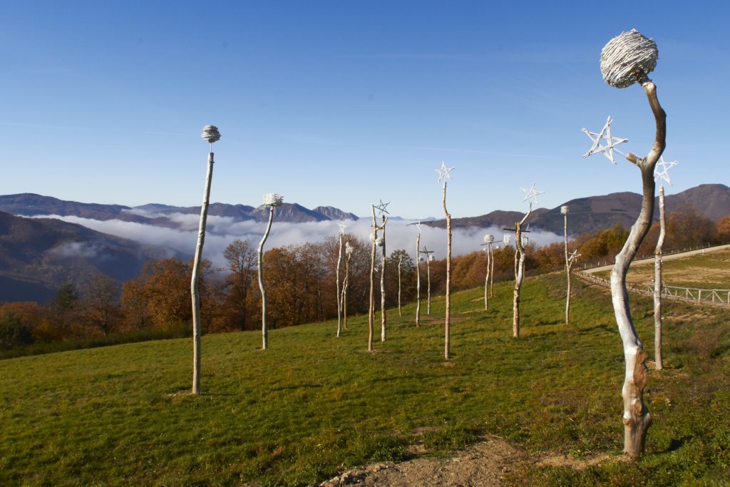
Once there, you are welcomed by the Parco delle Stelle, with two Land Art works: Giardino del Sole [Sun Garden] and Portatrici di stelle [Star carriers].
You will see a wonderful view, encompassing the Apennine mountain chain and the whole valley of the Limestre stream.
Level: easy
Slope: 200 metres approximately
Accessible with a stroller
Completion time: 1.5h return
Along the path you will find a picnic area and drinking water
Clicca qui per scaricare la mappa
⇒ For all suggested trails you will need suitable equipment: trekking shoes, mountain apparel.